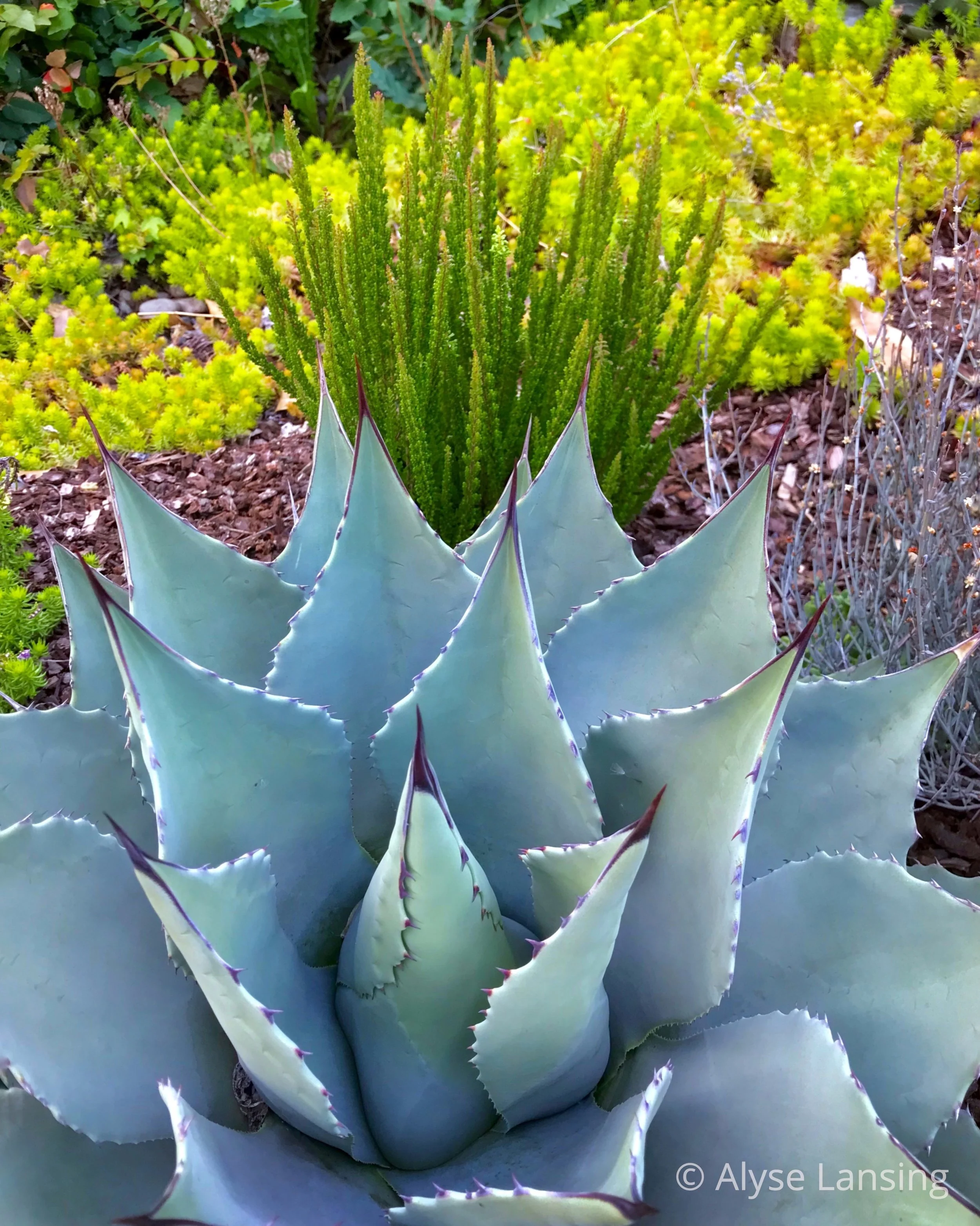
What the red bark of Manzanita does in summer
/
Rhythmic patterns of peeling bark - Arctostaphylos ‘Dr Hurd’
Read MoreRegarding all things that inspire the making and keeping of a garden
Rhythmic patterns of peeling bark - Arctostaphylos ‘Dr Hurd’
Read MorePleasant evening with friends in the garden of Heather Tucker and Greg Zwart. A tour with the creative director/head gardener herself.
Read MoreMaking smart landscaping decisions
Read MoreVisit this breathtaking space, “wash your spirit clean.”
Today’s take-away: the value of shadows, and detail.
Wednesday Vignette - our yard - Quail! Witch Hazel in bloom. Birdseed-feeding wildlife menagerie. New patio area and deer fence in progress.
Read MoreIn honor of Wildflower Wednesday, I return to the Lady Bird Johnson Wildflower Center, a beautiful, warm place for an armchair revisit.
Read MoreThe wild and wooly Lady Bird Johnson Wildflower Center, thunder rolled
Read MoreThis many blooms are a rare sight in my deer country garden.
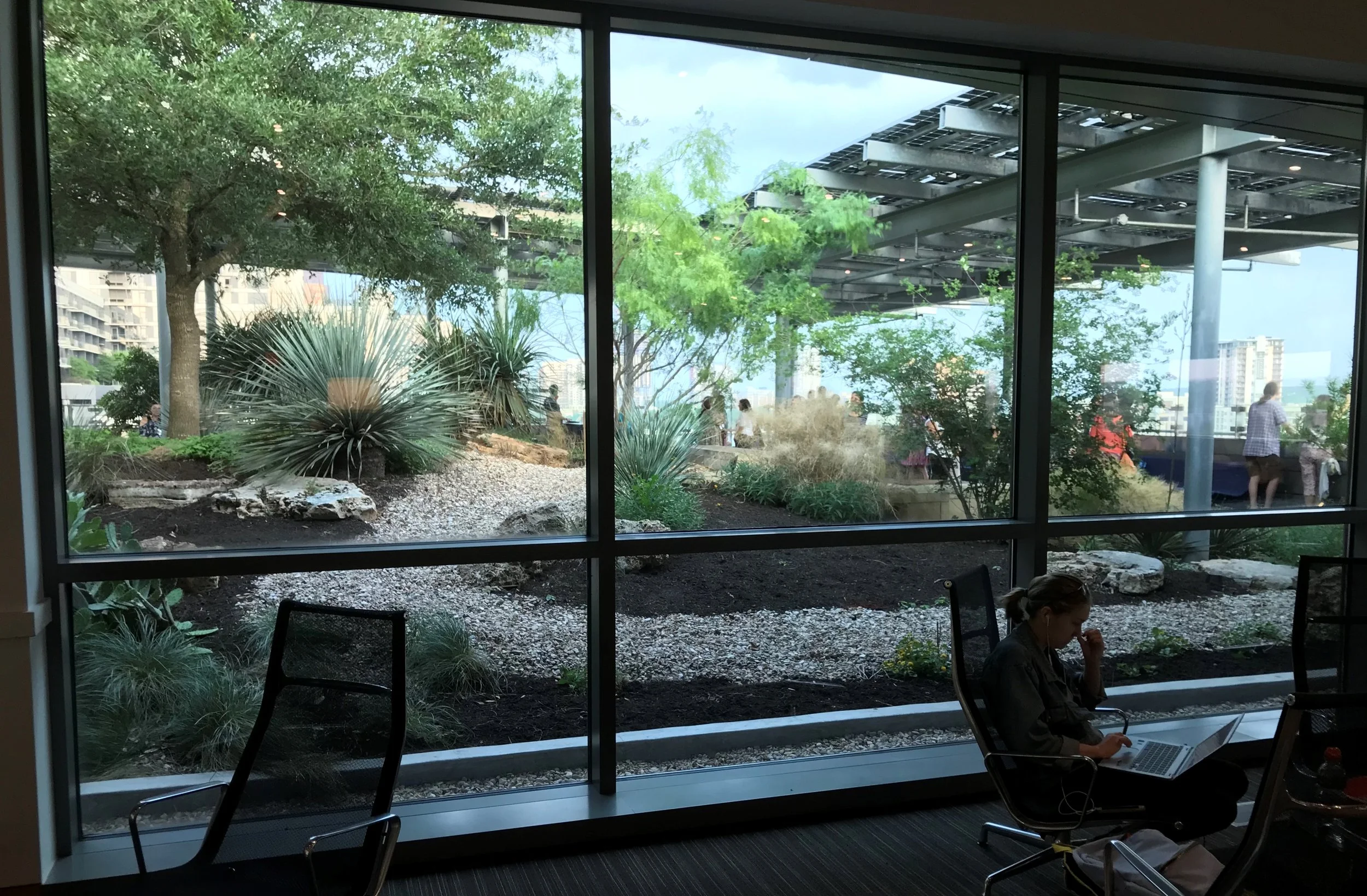
Read MoreWhat kind of gardens did Austin have in store for us? What kinds of conversations do affable, like-minded plant nerds have on rooftop gardens? Here’s a beginning.
Read MoreThe lovely Lomatiums that most have never heard of… I share some pretty Desert Parsley views in the Columbia River Gorge, starting ten miles up the Klickitat…
Read MoreInspired by Urban Jungle style, a trip to one of Portland's unique nurseries--this time for indoor plants.
Read MoreImages by Amy Campion, from the new book Gardening in the Pacific Northwest: the Complete Homeowner's Guide, by Paul Bonine and Amy Campion.
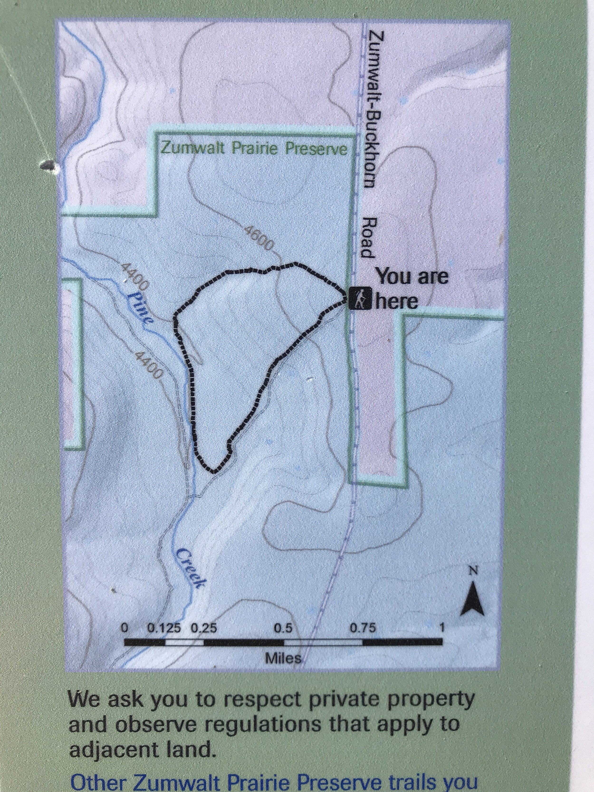
Read MoreProfoundly peaceful Patti's Trail compels you forward to the Zumwalt Prairie breaks.
Read MoreThere is a Preserve in far northeast Oregon, on the plains above the Imnaha River and north of the Wallowa Mountains, where the native prairie is windswept and gorgeous and inspiring.
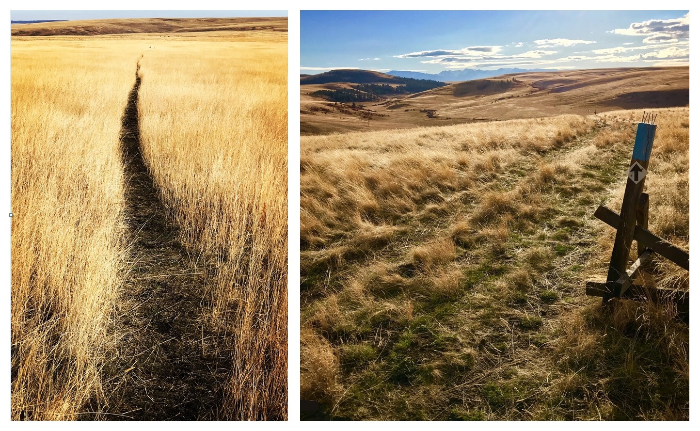
Zumwalt Prairie Preserve. Left: Patti's Trail. Right: Horned Lark Trail.
This is the Zumwalt Prairie Preserve, created in 2000 by the Nature Conservancy, a portion of which is now designated as a National Natural Landmark by the US Dept of Interior. It is one of the last and largest remnants of the native bunchgrass prairie that covered vast areas of the western states for millennia. There is very little of it now. The Conservancy works with a broad array of partners including local ranchers, looking for creative management practices to preserve what remains, and more.
They've also opened up parts of it so ordinary folks can walk this special place.

Zumwalt Prairie Preserve's large 51 square miles in far NE Oregon. Note proximity to LaGrande, Enterprise, and the Hells Canyon National Recreation Area.
I got to travel here in October, on three solo day trips while camping with my husband & family in the Wallowa-Whitman National Forest north of here. This was my first time to both Zumwalt and Wallowa-Whitman, privileged to spend a week with my in-laws who have been hunting off Chesnimnus Creek every year for 60 years.
I didn't know what I would find at Zumwalt. I'd hoped there might be trails, but I would have settled for whatever I could see from the road. How lucky I was! Not only were there trails, but they were easy to find, each about 2 miles, with gentle slopes, photogenic charm, perfect weather, and an utter quiet and stillness I have not experienced for a long, long time.
I'll begin from the Buckhorn Overlook, about 20 miles north of Zumwalt Preserve. This is where I started my day.
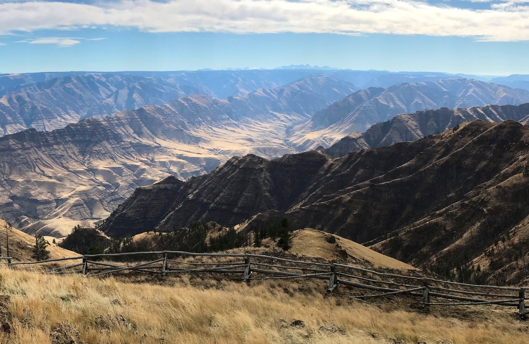
The Imnaha River canyon, as seen from Buckhorn Overlook, off Nat'l Forest Road 46.
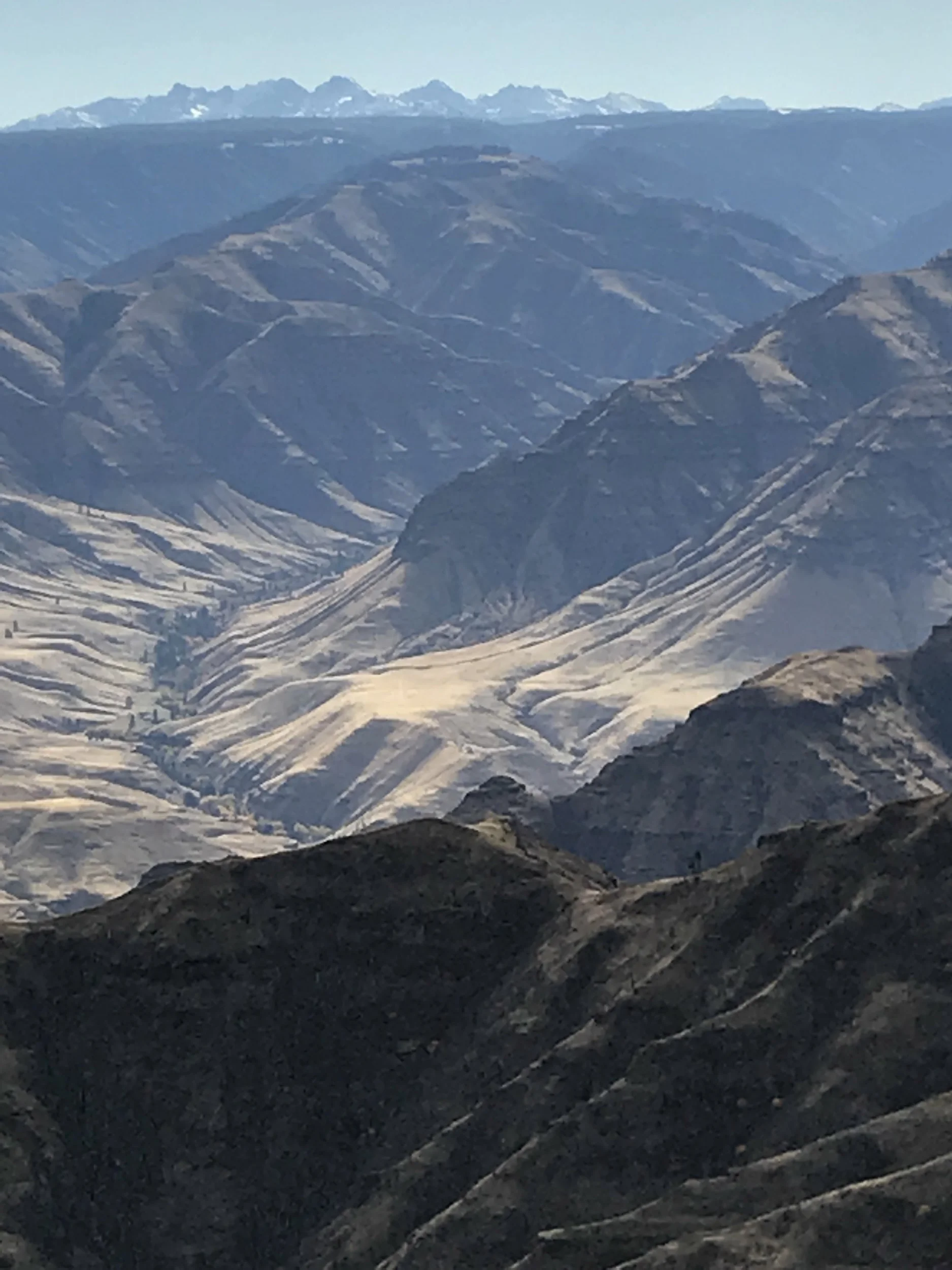
Oh how I regretted not having a telephoto lens for this trip! Even though a rough picture at best, I hope you get the idea. The Imnaha River country is strikingly beautiful. Idaho's Seven Devils Mountains in the distance.
While most folks drive up to Zumwalt from the south (from Enterprise or Joseph), I drove down from the north. So, instead of having the Wallowas to my back, I drove straight toward them.
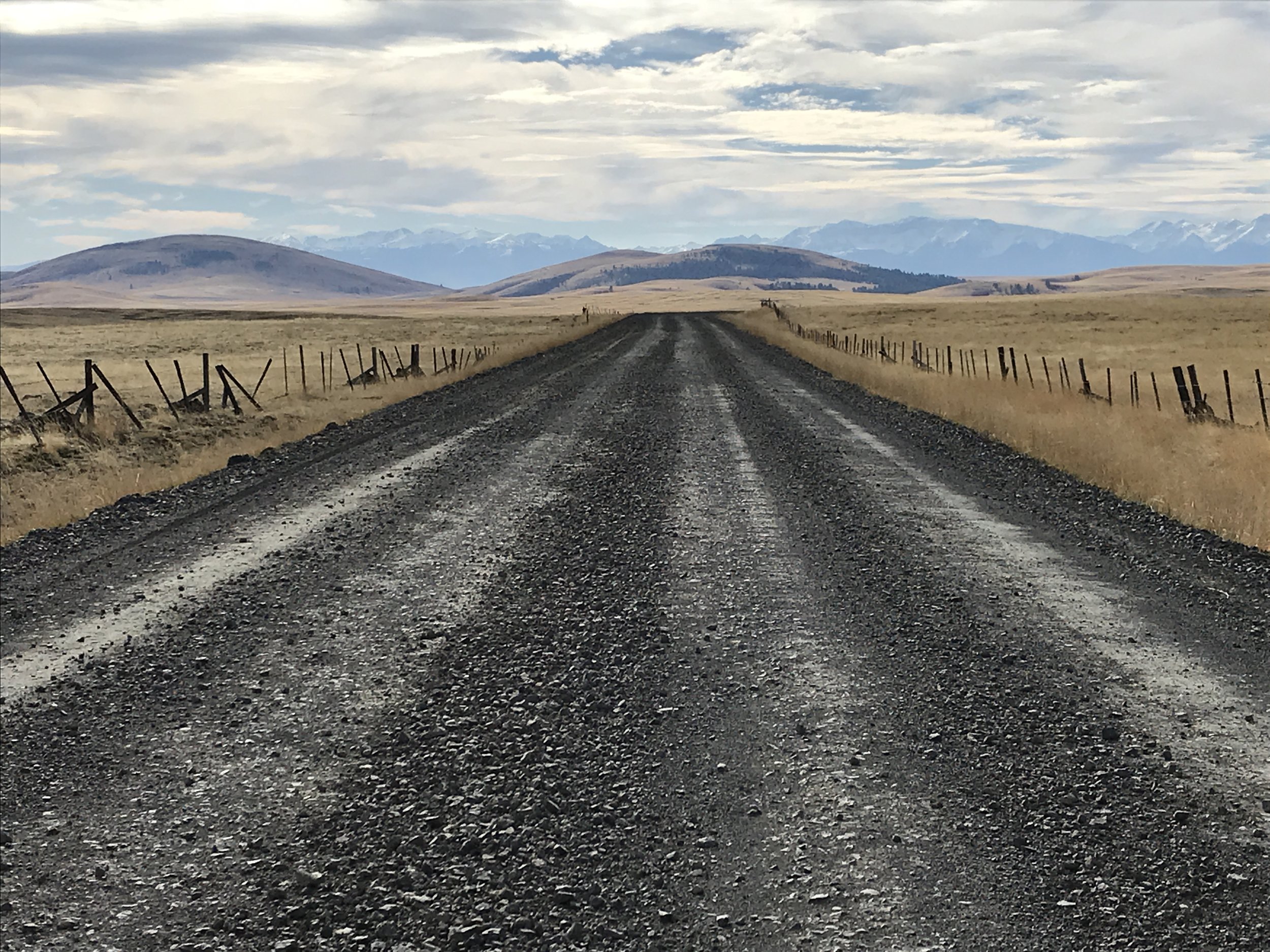
Zumwalt-Buckhorn Road (aka Zumwalt Road), the Findley Buttes of Zumwalt Preserve, and the Wallowa Mountains.
I'm still kind of reeling with how jaw-drooping this approach to Zumwalt was. Turns out that NF Road 46 becomes Zumwalt-Buckhorn Road, the main access to the Preserve. Even though of course countless others have traveled this road before me, it felt to me like I was discovering the moon. And for the vast emptiness-of-humans that this place was, in this particular sliver of time, I kind of was!
I hit the breaks when I saw this sign (below). I parked my rig and checked it out. Clearly, I was welcome here.
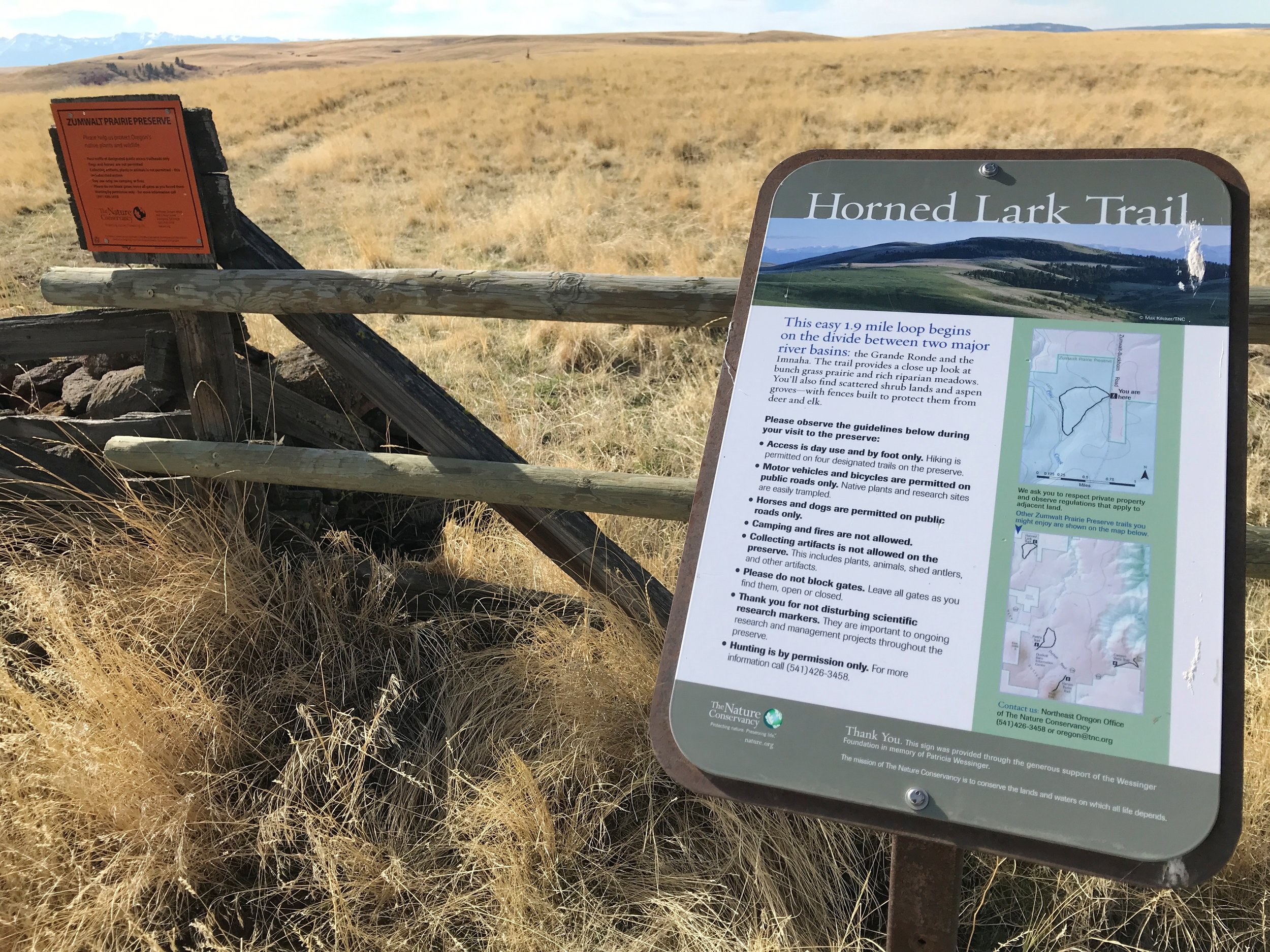
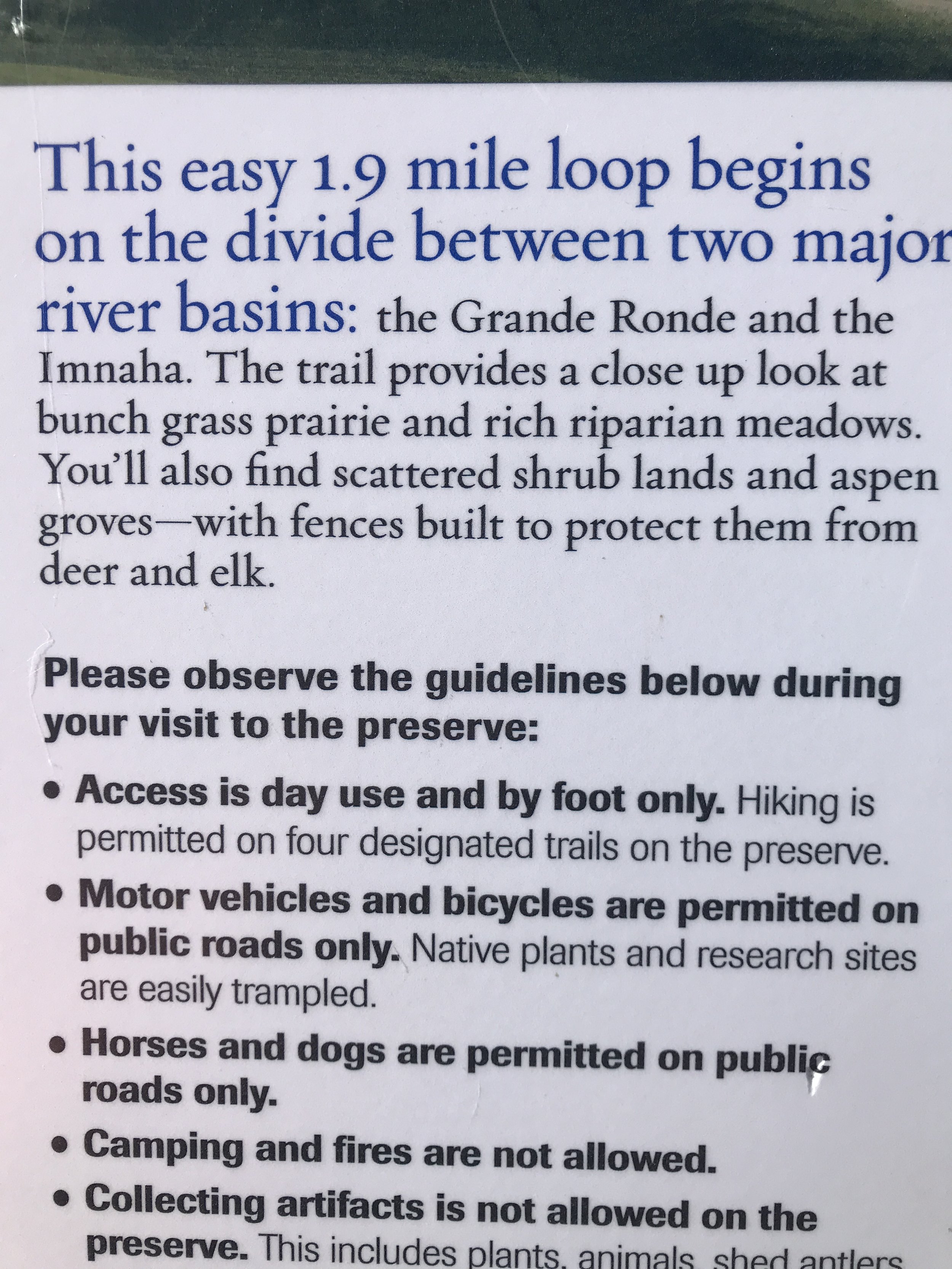
Noted: 1) No dogs (ground-nesting birds, extreme sensitivity to disturbance). 2) Day use only.
And 3) how cool that this is the high divide between the huge Grande Ronde and Imnaha watersheds. Meaning, this is a high, expansive plain like a terrace above the major canyons you can't see, but can feel, nearby.
I headed out to look over what the map told me was Pine Creek.
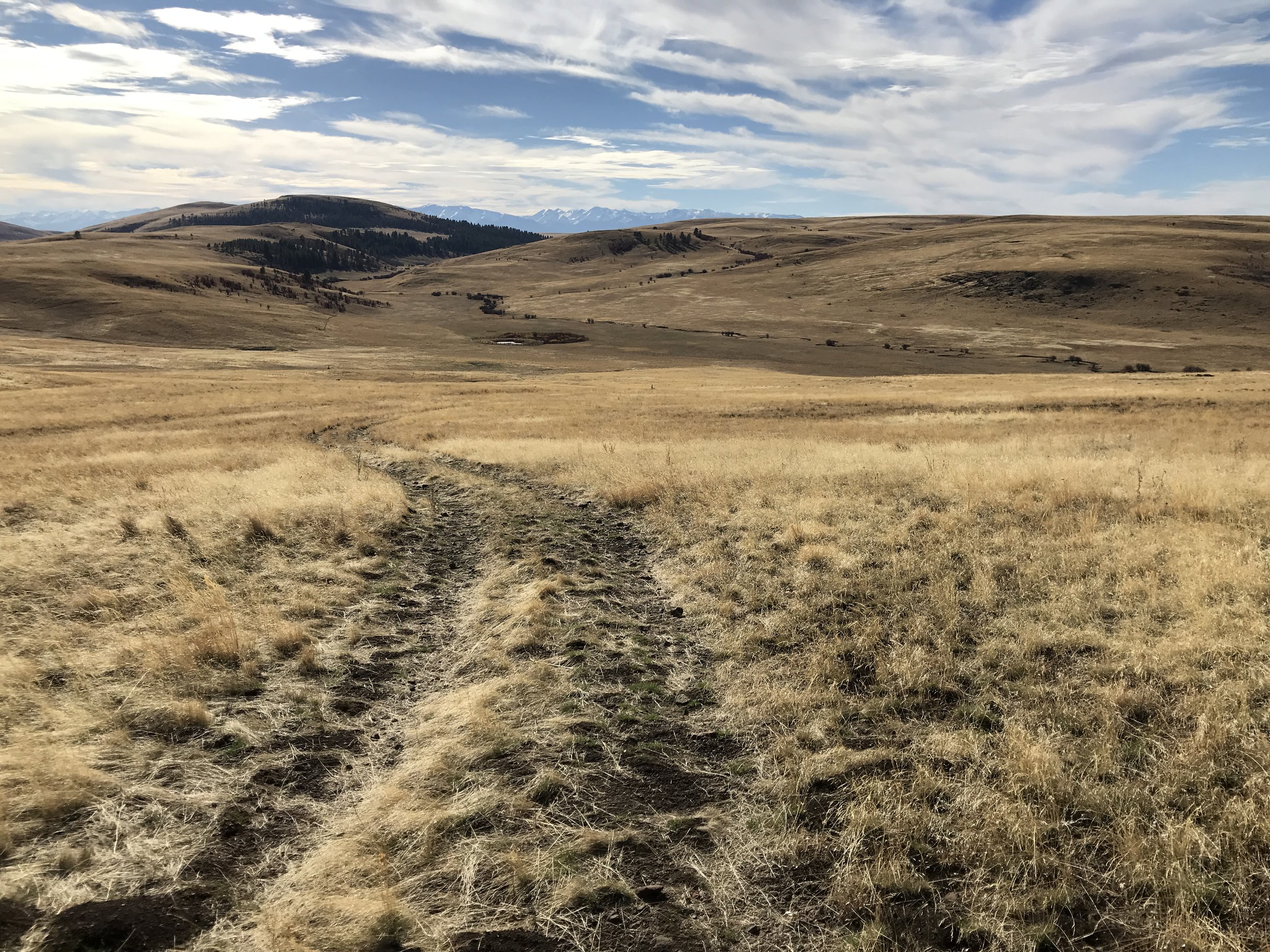
My initial intent was not to stray too far from my vehicle. But, there was this pretty creek down in that valley, and What was that circle of something down there...?
There's something about a sweet, clean line. I could take pictures of all day.

The circle of "what is that?" kept drawning me forward.
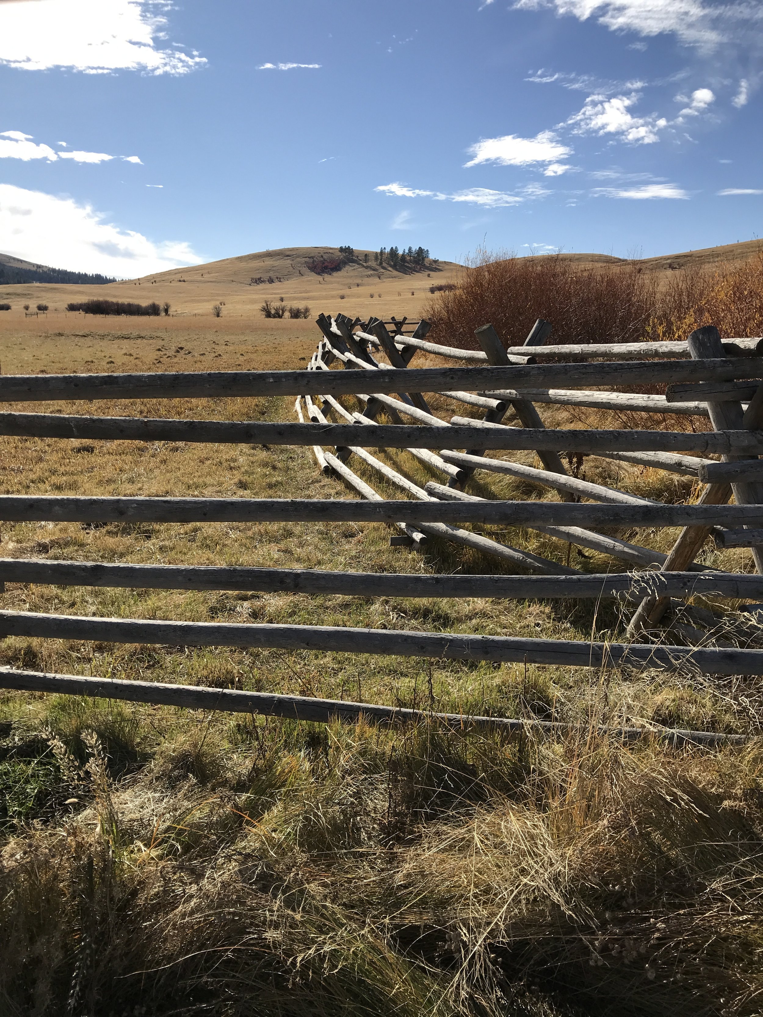
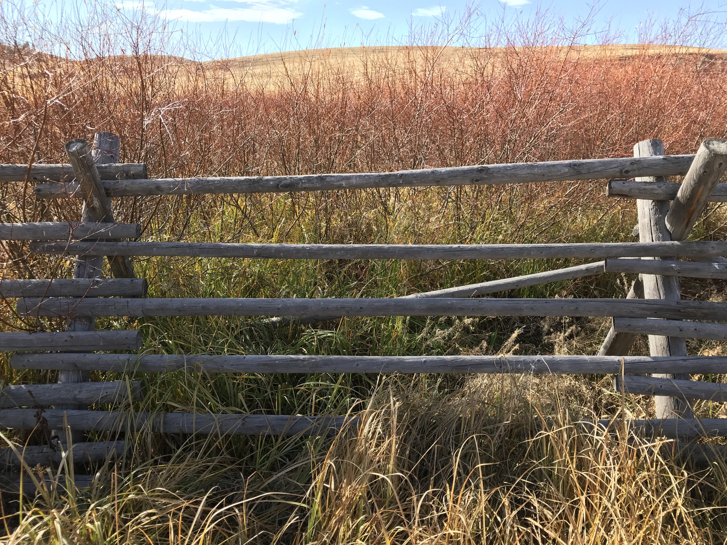
Turns out these fences are part of what signs stated are deer and elk protections for aspen stands and riparian areas. I studied their design, as I need deer protection at home and was curious how the wildlife managers did it here. I noted these fences were not particularly tall, but they did have width. And those horizontal slats, angled as they are, could they have a slight "cattle guard" effect(?), making voids that a hooved mammal might choose not to cross? Some of these fence types at Zumwalt felt so short they could not possibly keep out elk. It's possible they are more to keep out cattle.
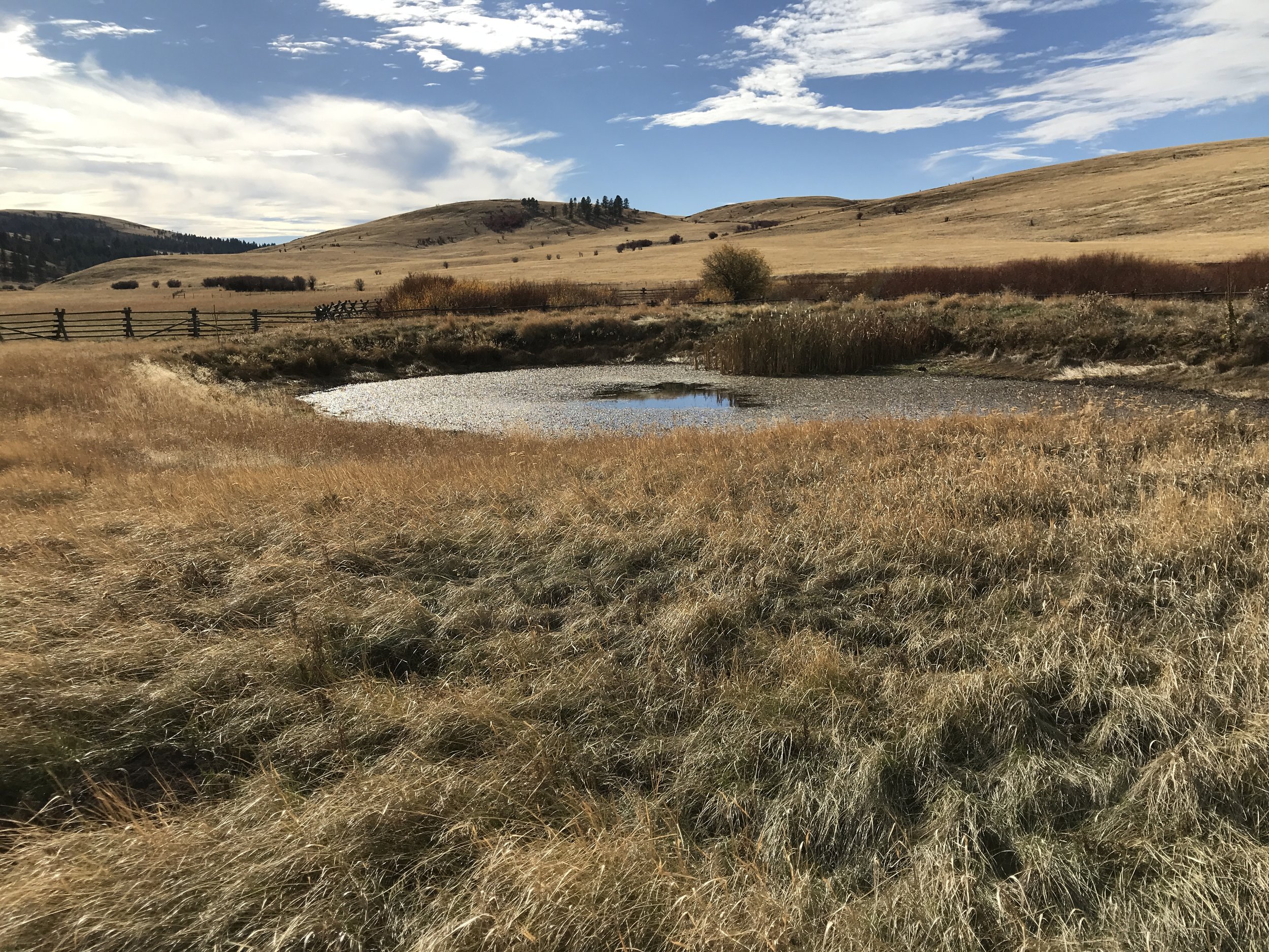
The circle that can be seen from the trailhead above is two overlapping circular fences and a circular watering hole. Cattle do graze this particular part of Zumwalt (none today), but they use an open-gated watering hole not far away.
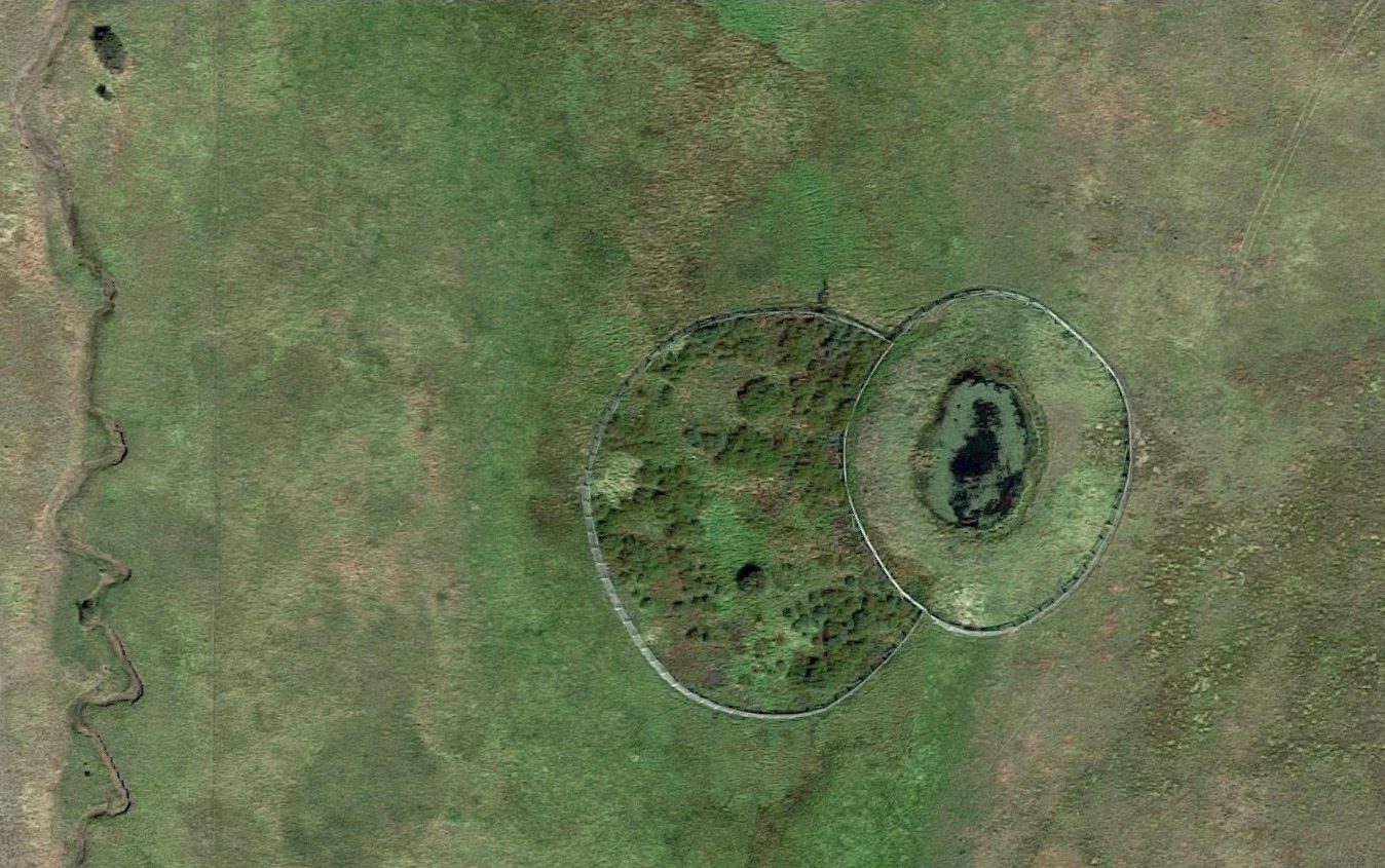
Google aerial image (springtime view) of the circular pond. Pine creek at left. The trail drops in from upper right.

The watering hole was a pond, and deep enough for plenty of swamp life. This was the leafy surface.
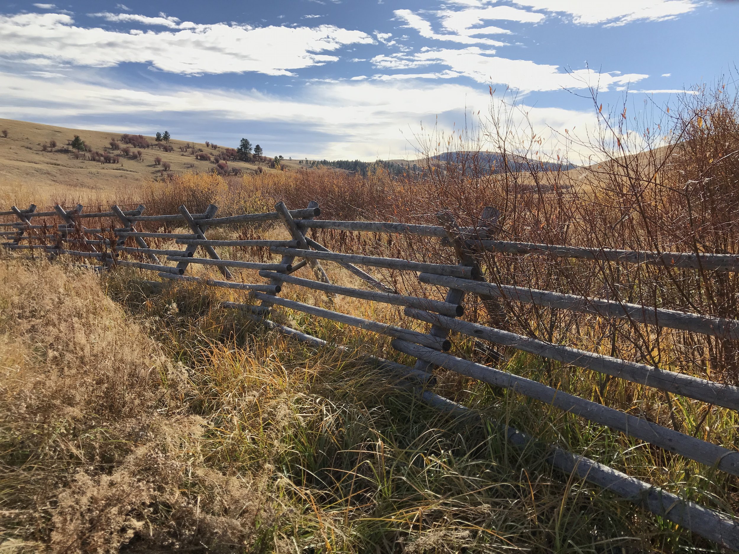
The timber material of the fence is handsome and substantially fits the site. Much nicer than wire.
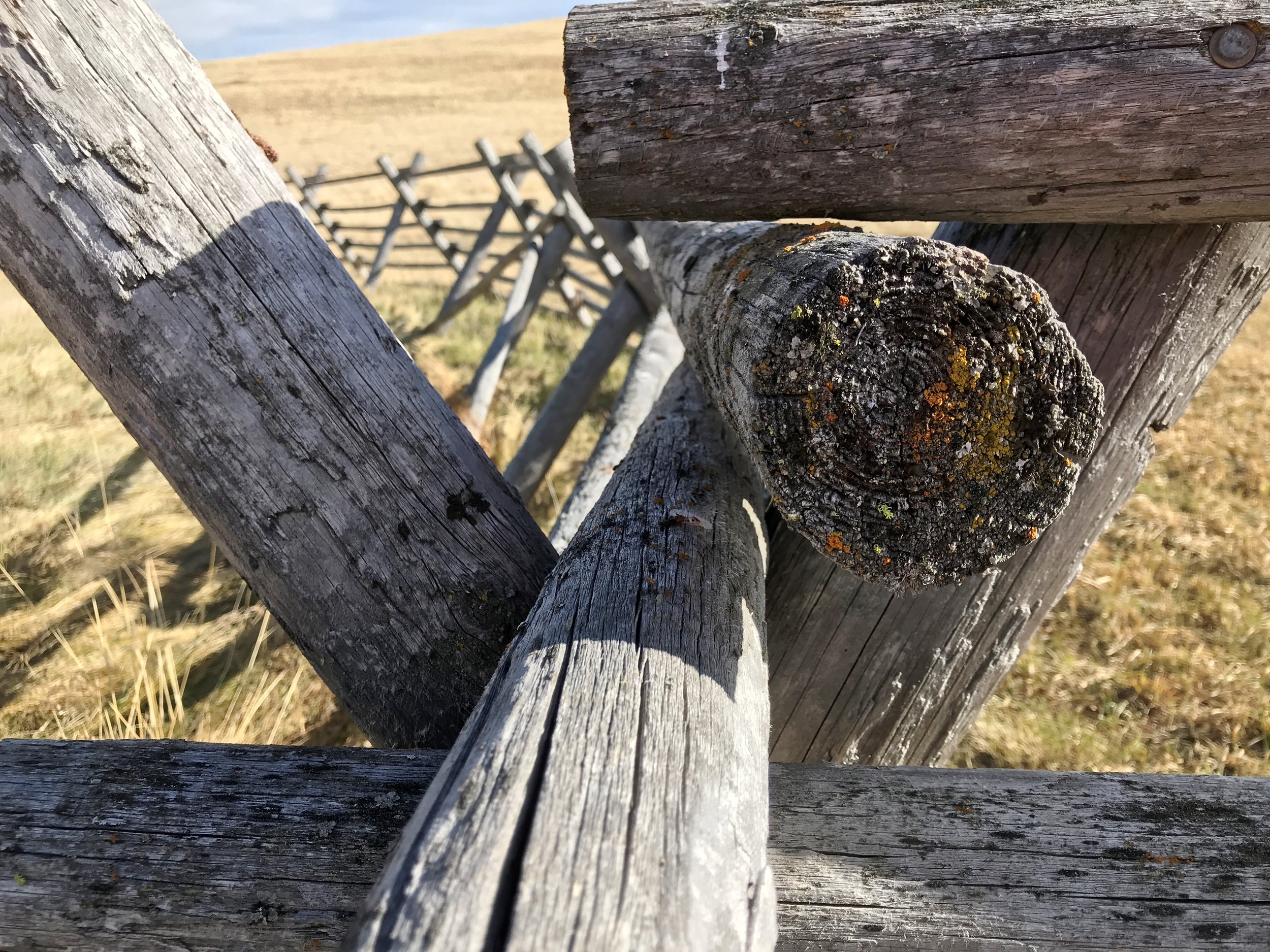

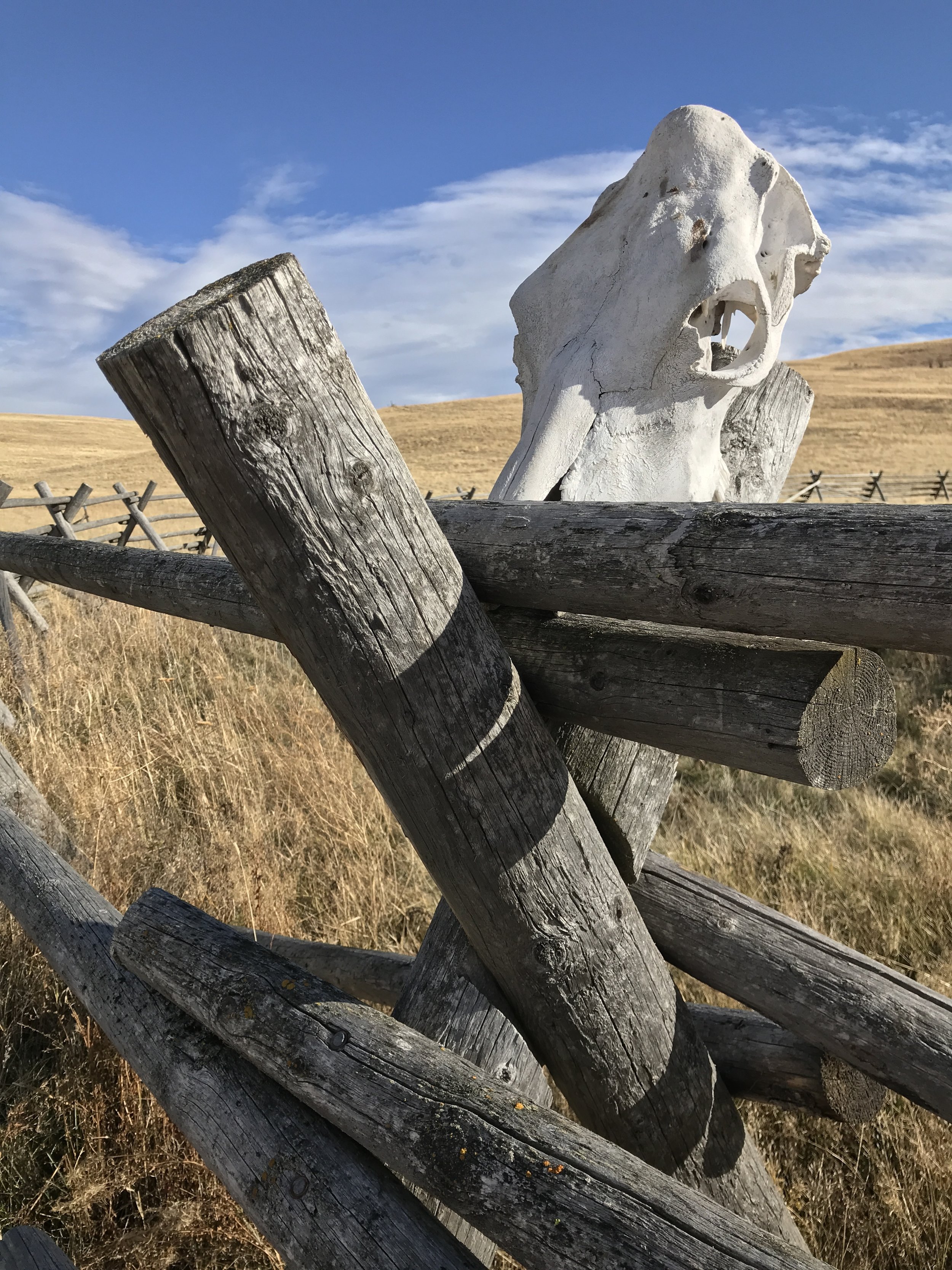
My Wednesday Vignette: Cattle skull, tripod fence, Zumwalt Prairie and eastern Oregon sky. Three photos.
*Wednesday Vignette hosted by Flutter & Hum. Click to see other intriguing vignettes of the day.
Cattle skull ornament.
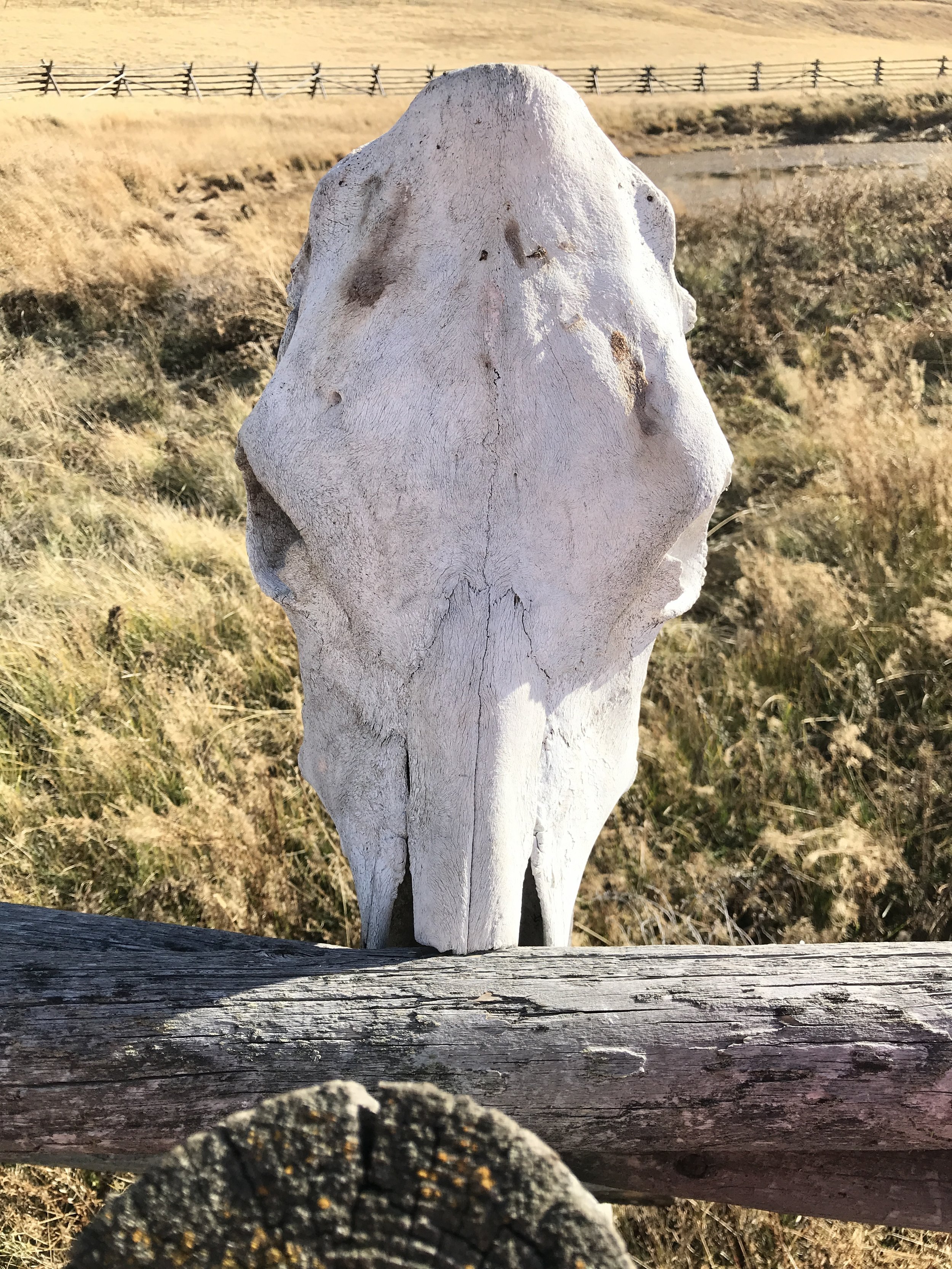
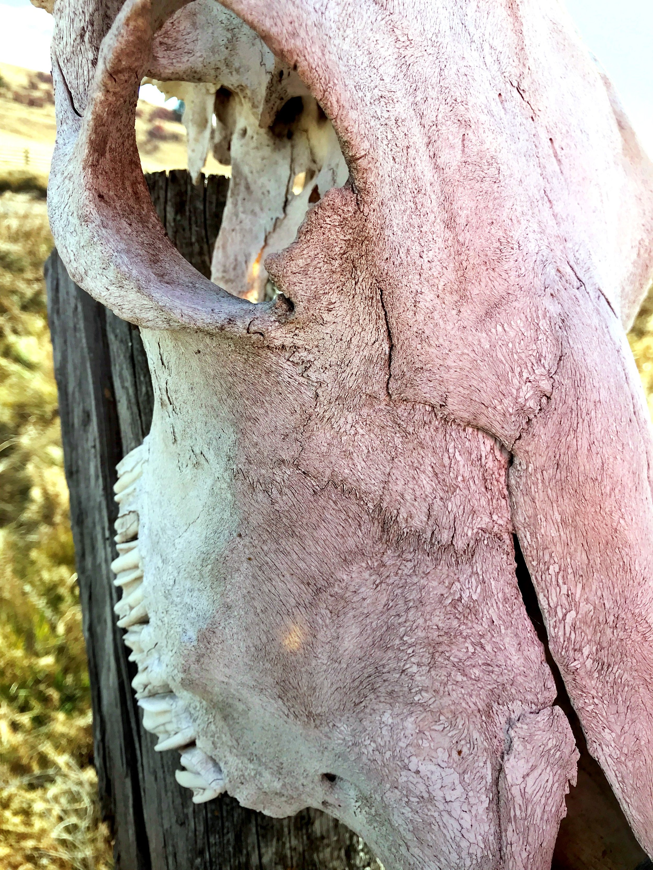
The skull was pretty cool, with its patterns swirling in the bone. The mathematics and rhythm of all Creation--it's amazing how much they repeat and have in common.
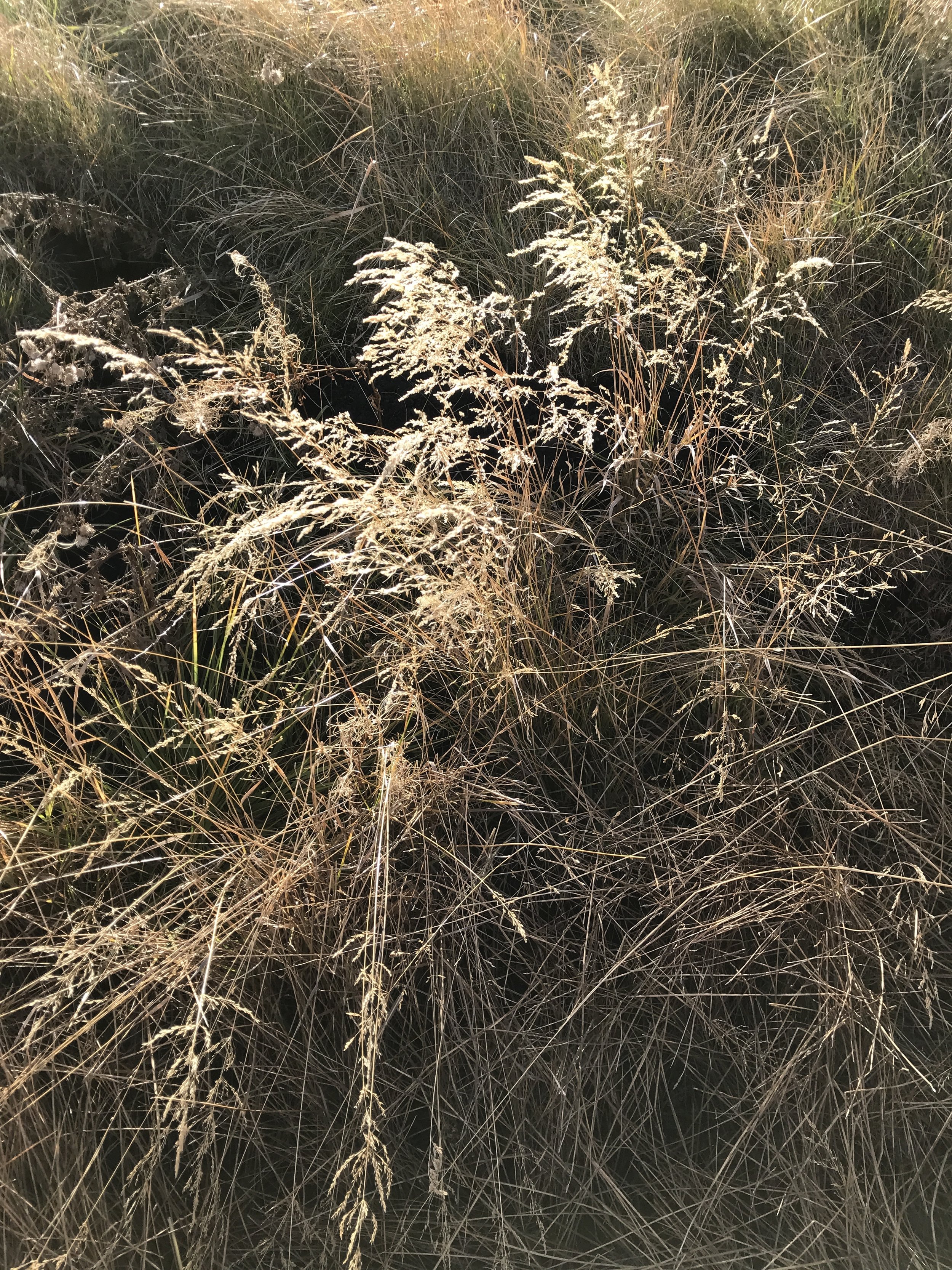
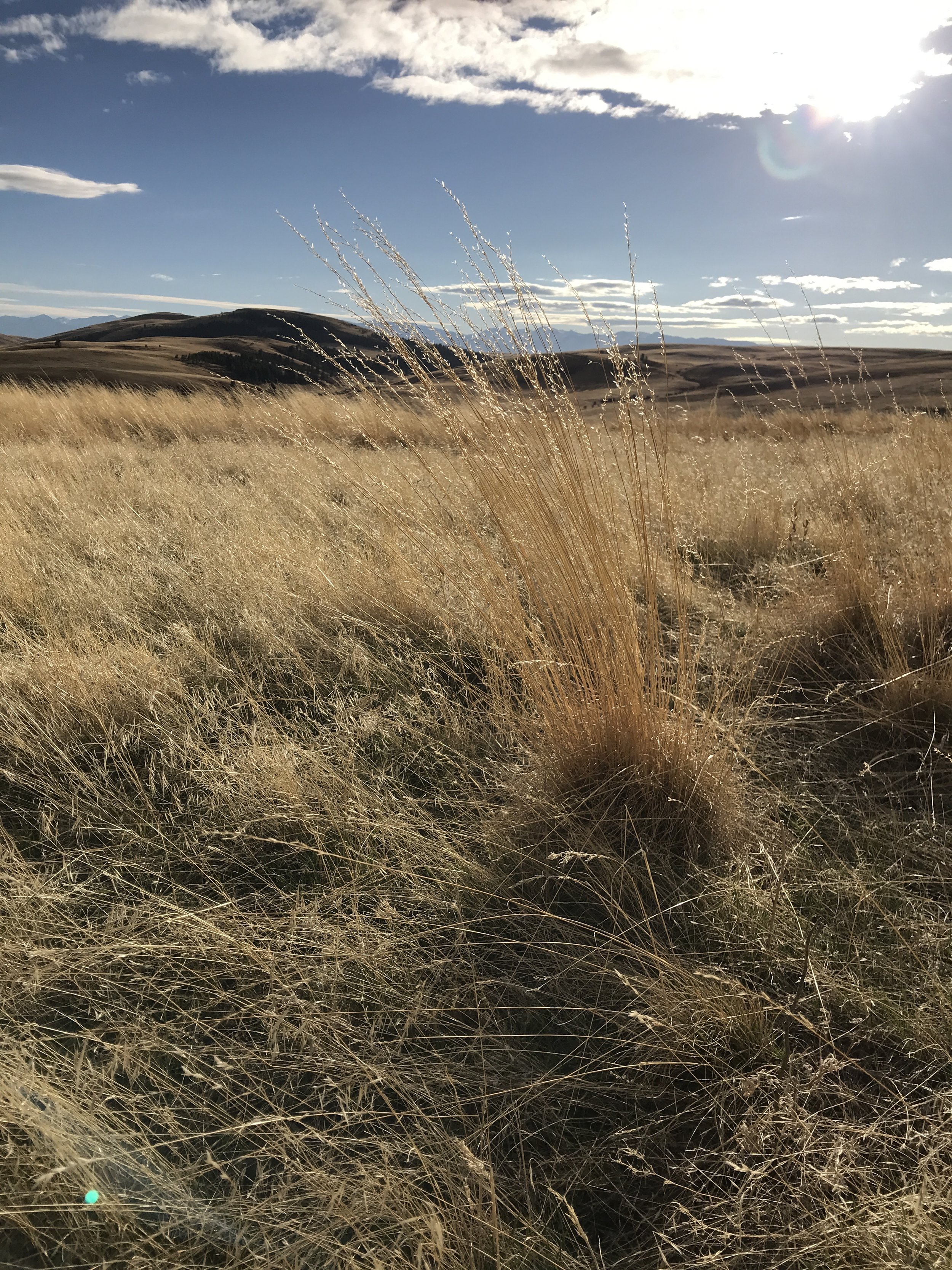
I would love to learn the identify of a few of the grasses. Took lots of photos of them. I would assume that most of these here are not native, but I look forward to learning more. My walk the next day (I'll feature in Part II) looked more native, with maybe restoration efforts to the grasses as well. There is a lot to the story of what's being done to protect biodiversity at Zumwalt. I look forward to learning more about that too.

All along Pine Creek, and throughout fall-colored slopes all over Wallowa County, this shrubby tree was common everywhere. I was curious what it was.
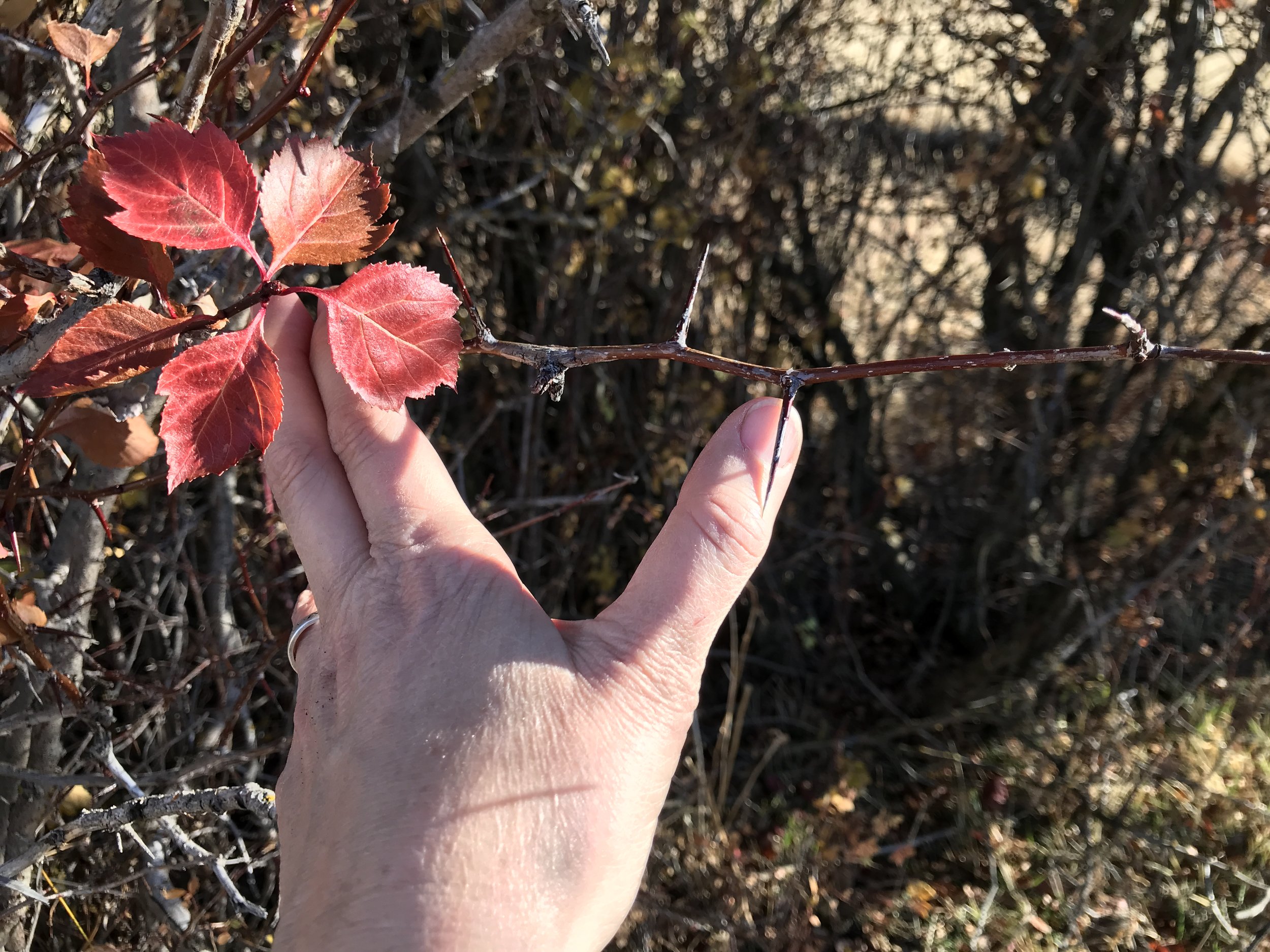
The thorns, leaf shape and fall color lead me to think it may be a Hawthorn. It's behavior as a thicket and the fact that it's the ONLY surviving shrubby tree in many many stands along this cattle-grazed creek (i.e. little else survives) also made me wonder about its provenance. It is clearly die-hard tough.
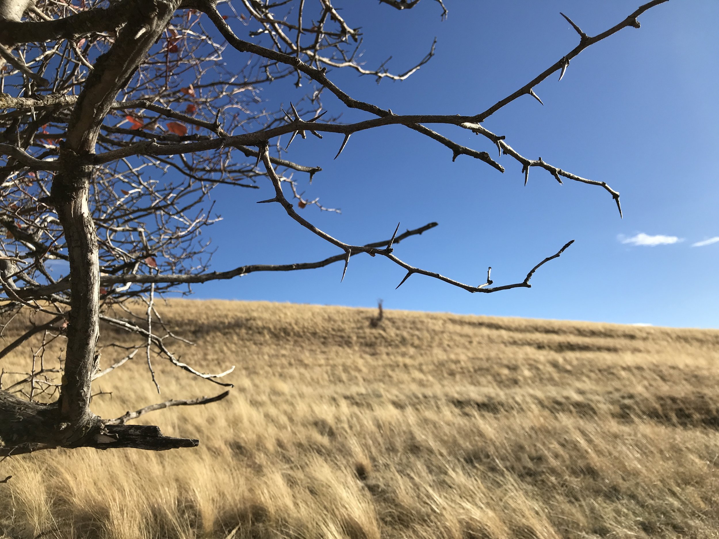
Is this the same Hawthorn or Hawthorn relative, further up the slope?
I saw it also further up the slope. This one was a lone specimen, in a windy draw.
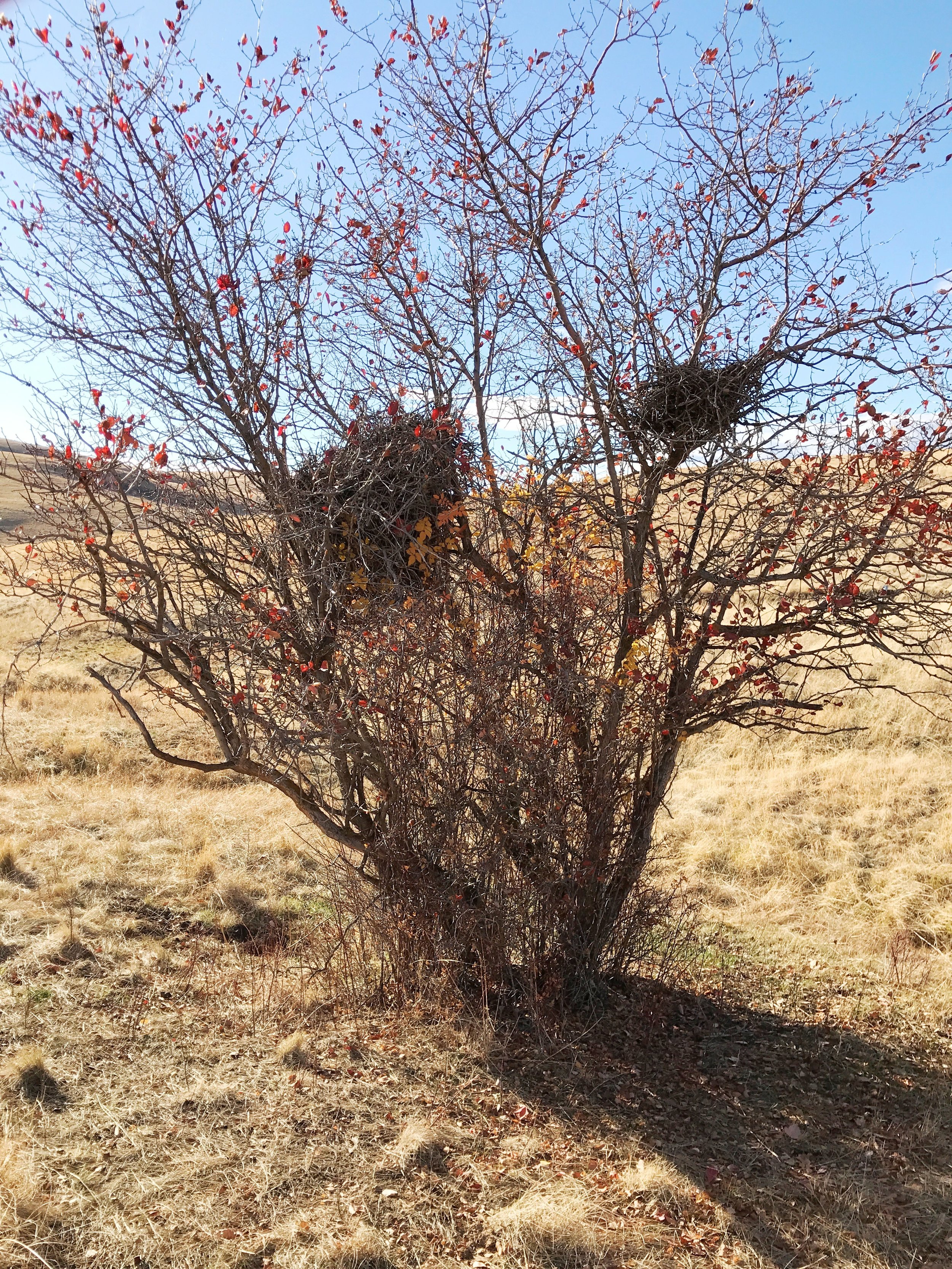
These nests in the [Hawthorn?] tree were huge! The big one is maybe 2' tall.
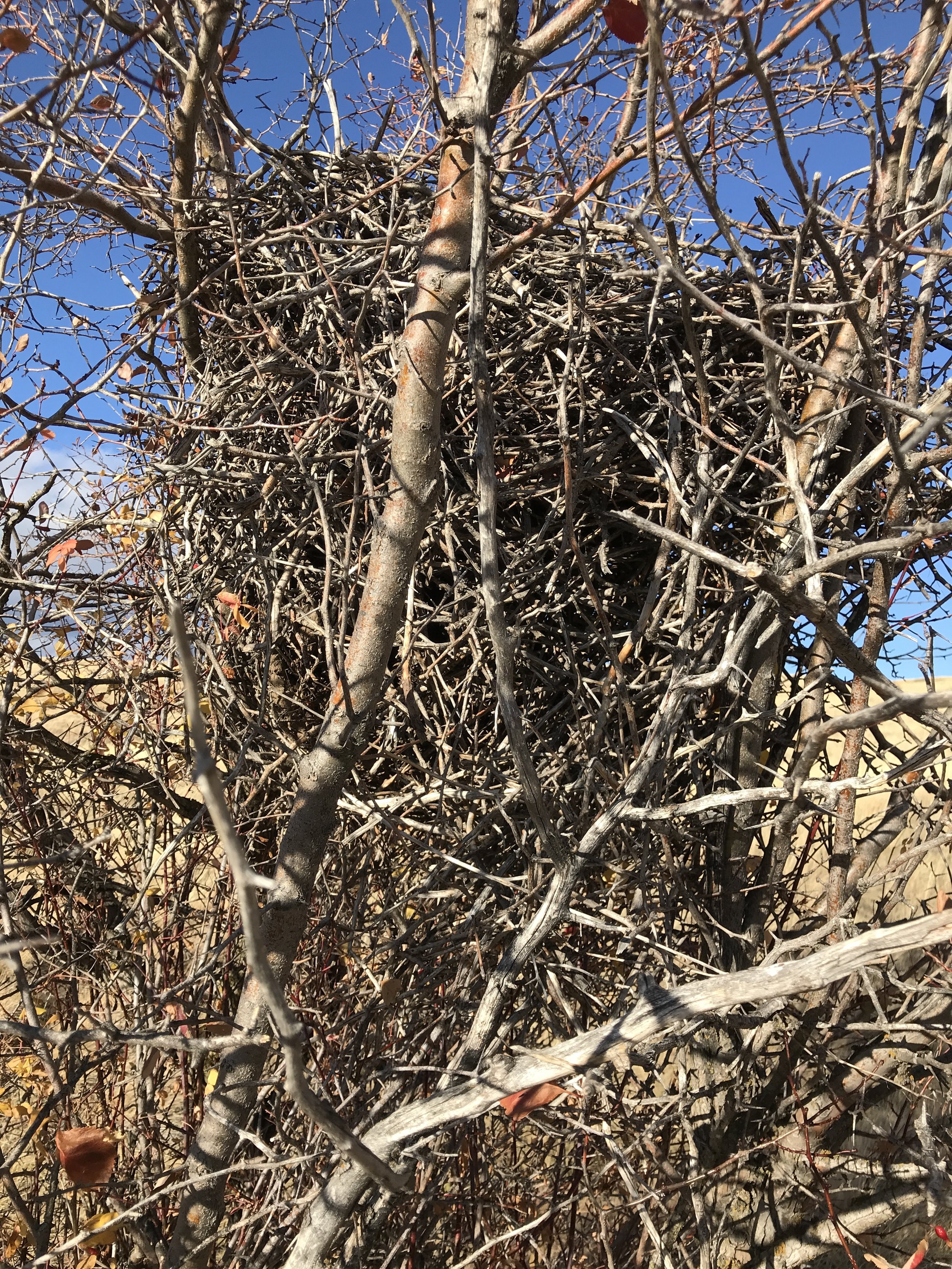
Anyone know the species that makes such a nest?
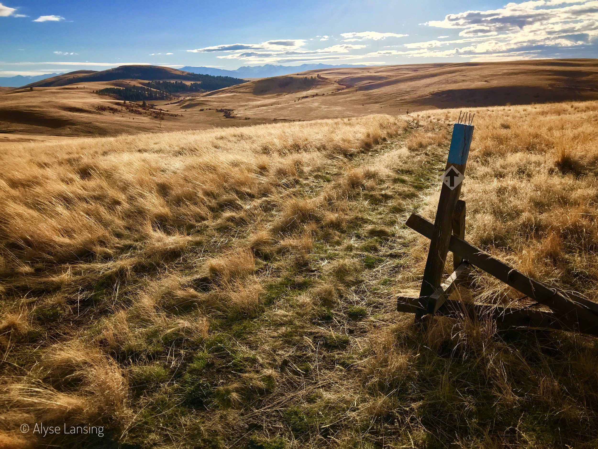
I lost the trail a bit as it looped back up through the far draw. But I could always spot one of the blue arrow direction signs. Easy enough to scramble across this plain.
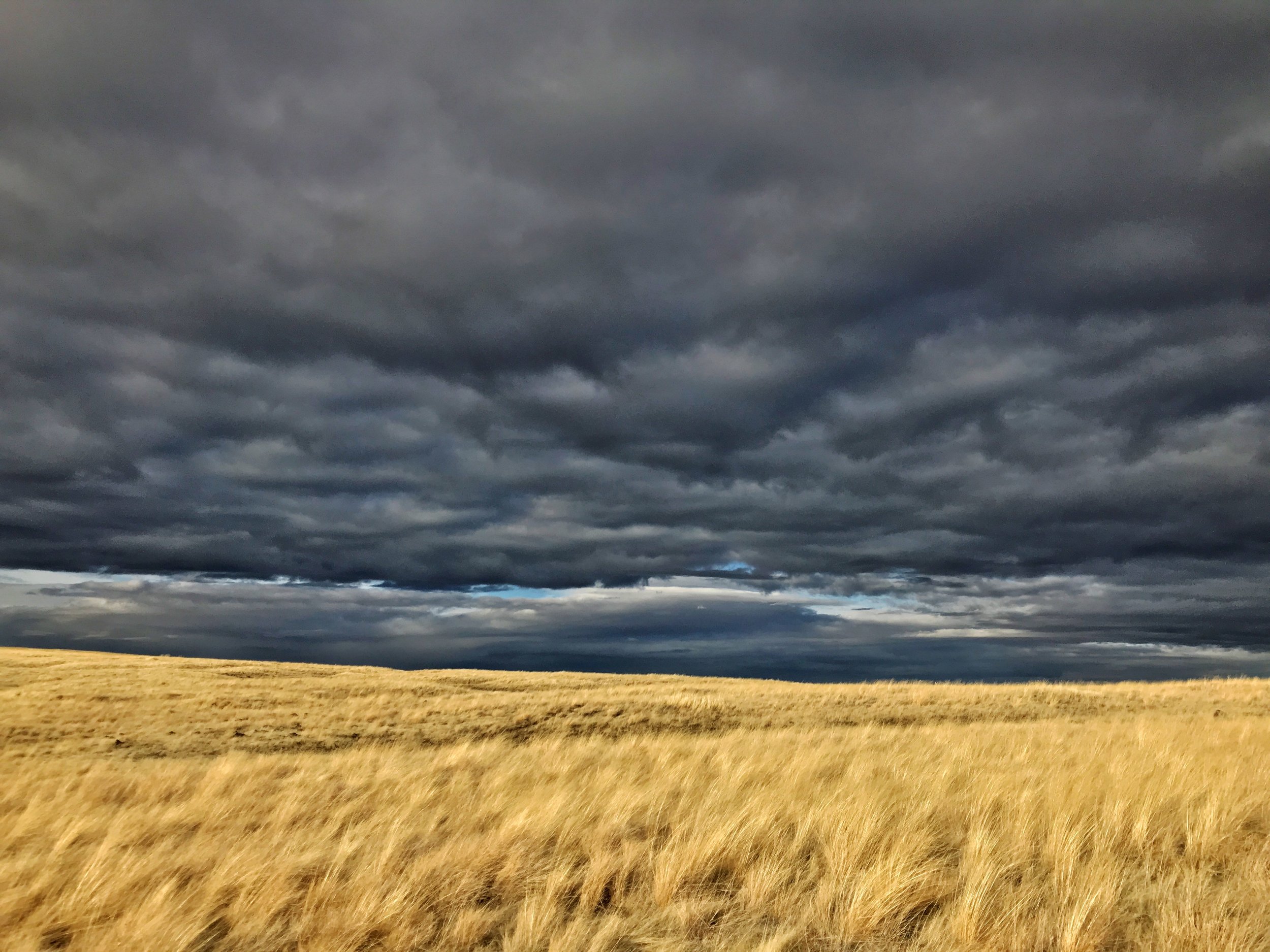
At the top, the weather was changing and the sky got dramatic.

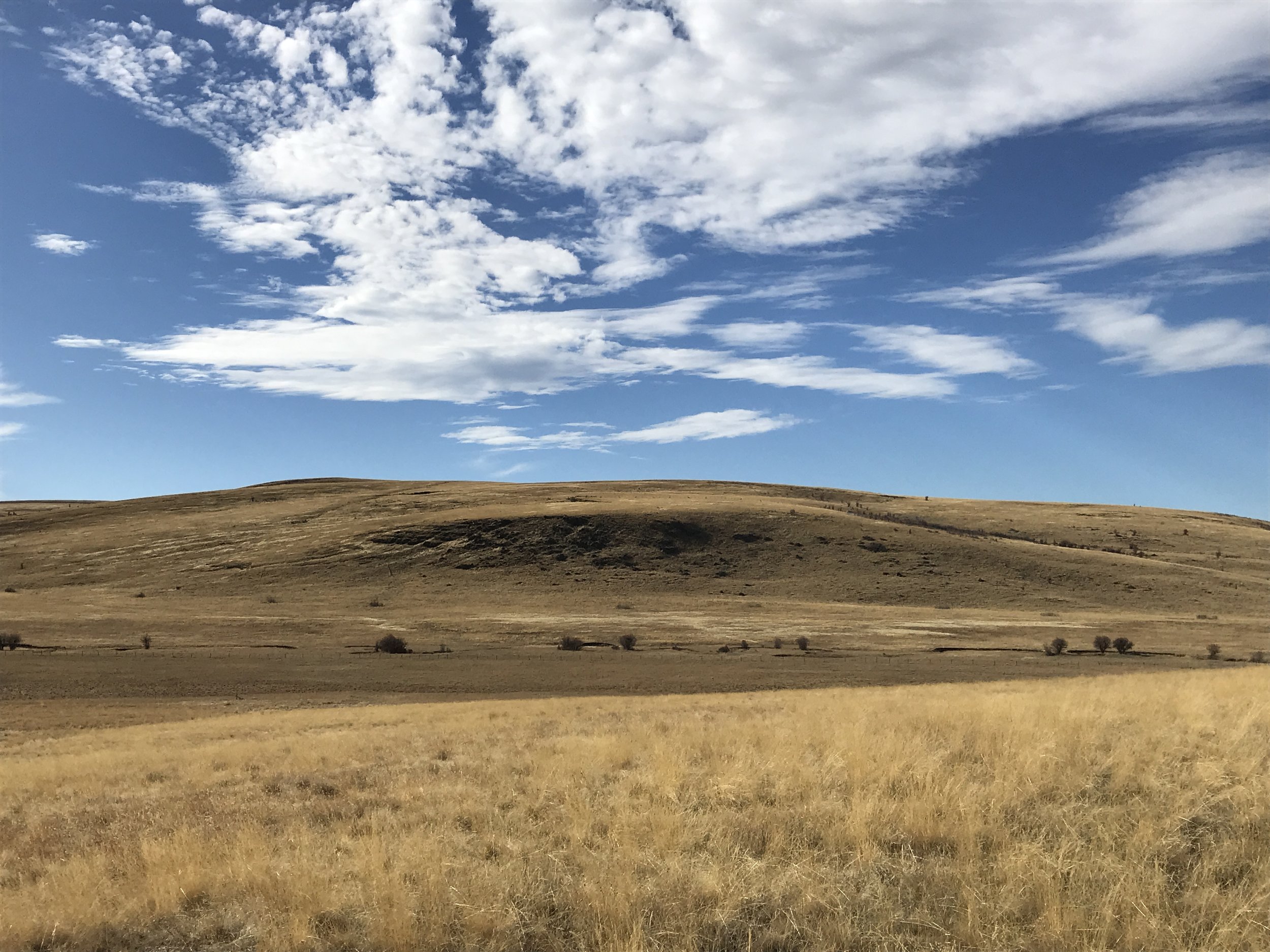
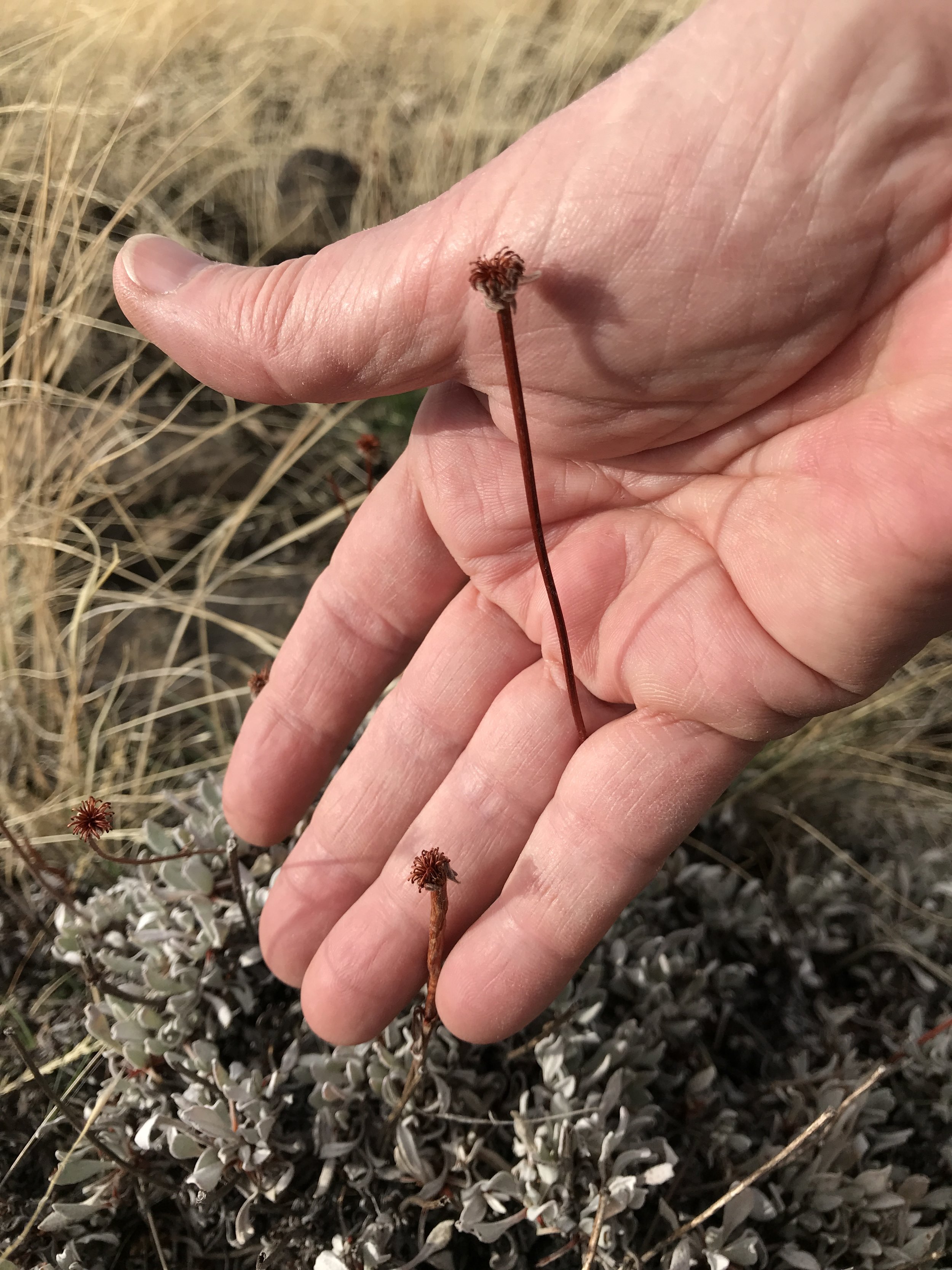
Buckwheat specimen 1 and elk droppings. Hand for scale.
I didn't see any elk, but know they are quite populated here. Took this photo of their sign in comparison with the small clumping plants of the plains.
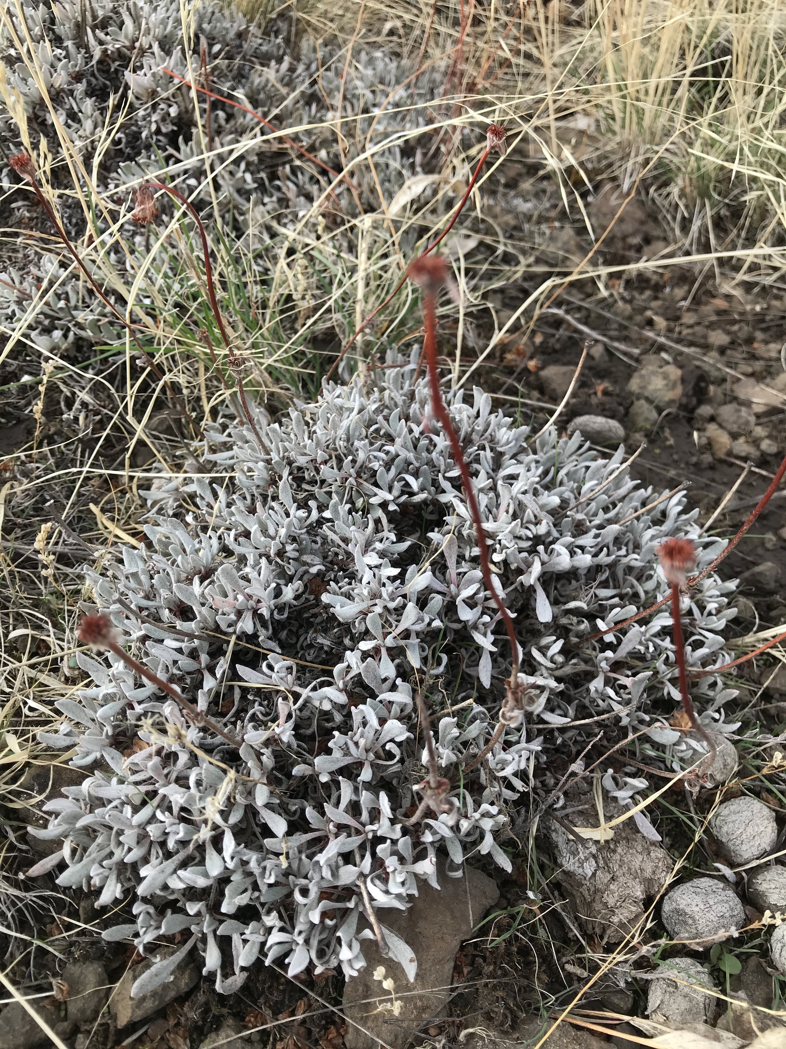
Buckwheat specimen 1.
An Eriogonum, one of the native Buckwheats. The plant ID-ing game is pretty tough this late in the season, but I took photos of some of the more prominent plants of interest (it helps my recognition that some of the native Buckwheats survive in gardens at home). This one (E. douglasii or heracleoides?) is obviously very tough, surviving in exposed, rocky, droughted soil, and remaining evergreen so deep into the season.
Dried flowers of Buckwheat specimen 1.
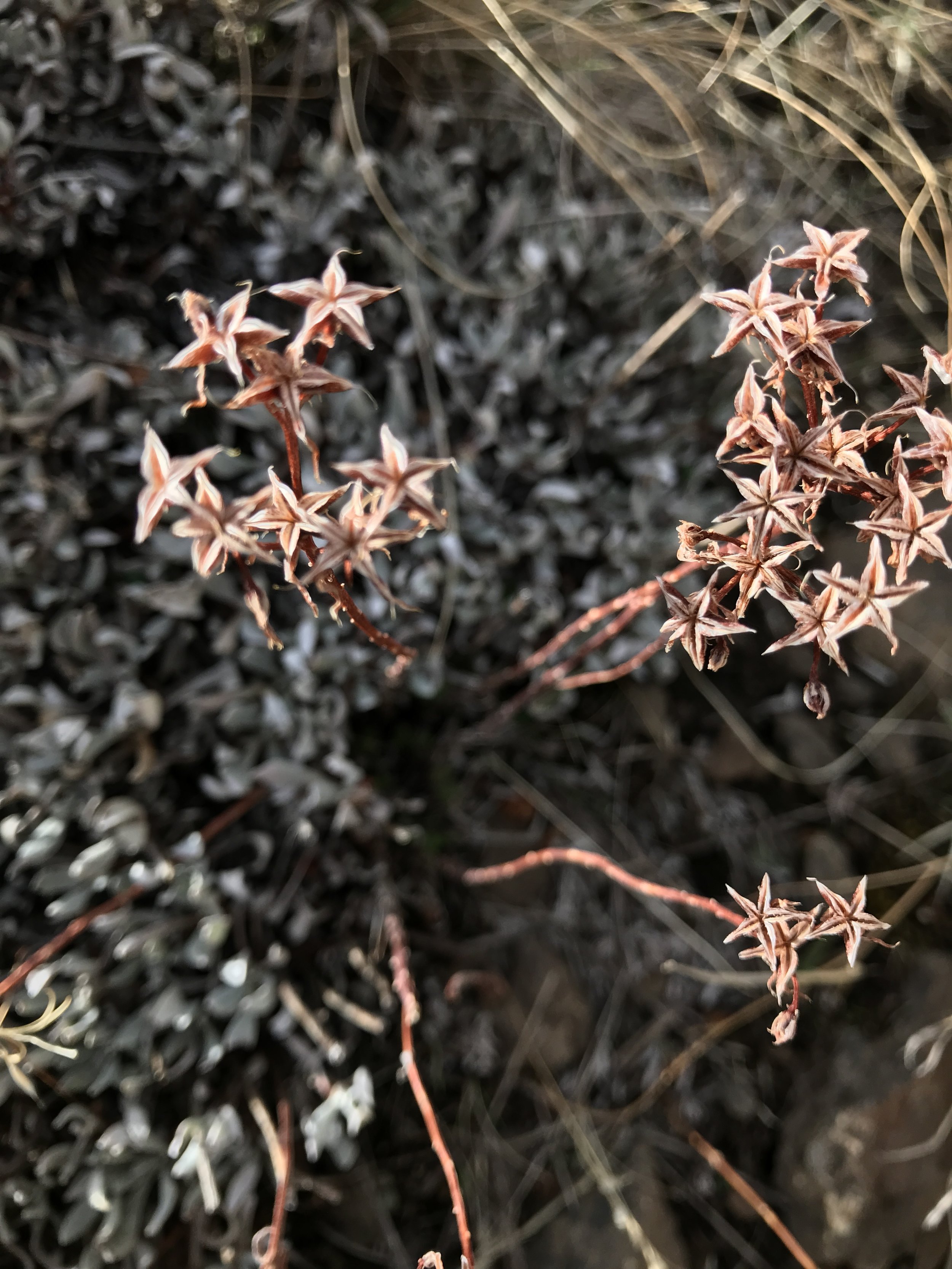
This starry-flowered plant grows natively on a rocky bluff near my home. I've yet to trace it "backward in time" to its blooming phase, so that I can identify what it is. Will the flower be as pretty as these dried flower sepals?
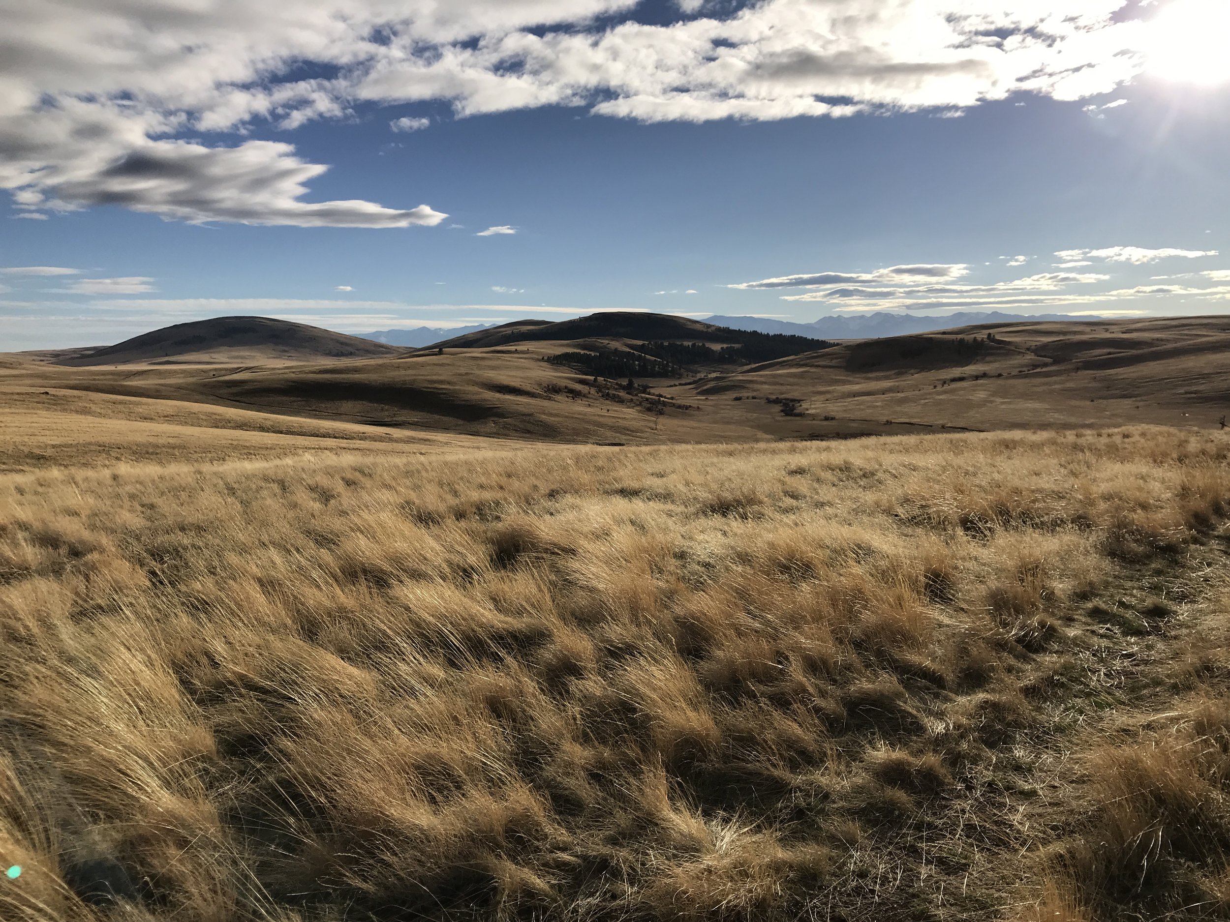
Two of the Findley Buttes that mark the Zumwalt Preserve, and the Wallowa Mountains behind them.
Can I describe to you the sound of wind in these grasses? Imagine: no other living soul out here, miles and miles of rolling plain, and silence broken only the wind across these grasses. You could stretch your soul to it.
The sun was setting on this day's walk over Horned Lark Trail.
The light—again—was flooring me.
I live and breathe for such moments! And...sigh...the allure of a compelling path.
This day was coming to a close, but, unbeknownst to me at the time, there was an even more "compelling path" the next day. Come back next week for Part II, and I'll show you one of the most compelling paths I have ever seen.
For info and directions to Zumwalt hiking & wildlife viewing, click here (see the Visit tab). Trails map is here. Peak wildflower blooming: June to early July. Raptor viewing is also well-renouned. The prairie is at about 4000' elevation.
Bring a vehicle that's comfortable on gravel roads. There were no restrooms and no water when I visited in October 2017. Dogs not allowed on trails due to sensitivity of ground-nesting birds and other species.
Your comments below, as always, much appreciated.
Cyclamen hederifolium - among the prettiest of fall flowers for your garden, easy to grow
Read MoreA silo in elegant decay, and the lesser-loved plants of the world (some say weeds)...make for some beauty at the farm. As does a day with my father-in-law, and the spirit of my husband's mom.
Read MoreMorning light in the kitchen window...and a vase of Oakleaf Hydrangea and Eucalyptus 'Baby Blue'
Read MoreSeven fresh and elegant private gardens on Portland's westside, open with the Association of Northwest Landscape Designers.
Read MoreA rare day of Tibetan tree peony, pink flowering dogwoods, and my first garden bloggers' plant exchange in Matthew's garden.
Read MoreCreative residential landscape design serving the greater Portland OR area and Columbia County OR. Planning comfortable gardens and living spaces as extensions of your home.
With this platform I explore the inspirations behind good gardens—beauty, nature, ideas from travel, garden tours, journeys (trails), plant composition, spacial design, natural ecosystems, etc. I’m passionate about what gives certain outdoor spaces their spark, what makes them comfortable, or uplifting, or healing. The best gardens have love and “Life” behind them. An indefinable quality, but you feel it.
My own garden is in Scappoose, OR, USA, 25 minutes north of Portland, near the Columbia River. Zone 7b (occasional low 7ºF).
* * *
"Break clear away, once in awhile, and climb a mountain or spend a week in the woods. Wash your spirit clean."
—John Muir


Contact: 503-543-7129 | email here
All photography by © Alyse Lansing, all rights reserved.